
Tuesday, March 4th, 2025
Tetra Tech won three MAPPS Awards for a single project using the Teledyne Optech CZMIL SuperNova. The awards include the MAPPS Award for Airborne Acquisition and Processing, the MAPPS Member Choice Award and the MAPPS Grand Award. ...

Friday, February 14th, 2025
An H3 rocket launched the Michibiki 6 navigation spacecraft from Tanegashima Space Center on Feb. 2, 2025, to a geostationary transfer orbit, deploying it there 29 minutes after launch as planned. Image Credit: JAXA
Tuesday, February 4th, 2025
When NASA and the Indian Space Research Organization’s (ISRO) new Earth satellite NISAR (NASA-ISRO Synthetic Aperture Radar) launches in coming months, it will capture images of Earth’s surface so detailed they will show how much small plots...
Tuesday, January 21st, 2025
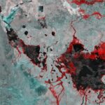
Located in the South Pacific Ocean, about 3,900 kilometers east of New Zealand, Point Nemo is also known as the “Pole of Inaccessibility” because it’s the farthest point from any land on Earth. With no inhabited islands...
Tuesday, January 7th, 2025
The upcoming U.S.-India NISAR (NASA-ISRO Synthetic Aperture Radar) mission will observe Earth like no mission before, offering insights about our planet’s ever-changing surface. The NISAR mission is a first-of-a-kind dual-band radar satellite that will measure land deformation from earthquakes, landslides and...
Friday, November 22nd, 2024
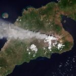
This Copernicus Sentinel-2 image from Nov. 13, 2024, shows the Lewotobi Laki Laki volcano eruption on the island of Flores in southern Indonesia. Mount Lewotobi Laki Laki started spewing ash and smoke on Nov. 4, 2024. It has, so...
Friday, November 8th, 2024
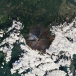
Mount Fuji, Japan’s highest peak, has seen its first snowfall after one of the longest periods without snow since records began 130 years ago. The Copernicus Sentinel-2 mission captured this image of Mount Fuji's iconic snowcap on...
Monday, October 28th, 2024
On Oct. 28, 2024, an ocean exploration expedition named Lebuu’s Voyage set sail aboard Ocean Exploration Trust’s (OET) Exploration Vessel (E/V) Nautilus to explore deep-sea habitats within Euotelel a Klingil a Debel Belau, the Palau National Marine Sanctuary (PNMS). Eleven...
Friday, October 11th, 2024
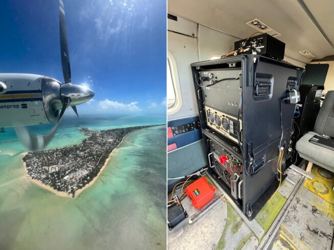
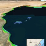
Multiple recent incidents in which naval and commercial vessels ran aground have highlighted the dangers of maritime operations in shallow or poorly charted coastal waters. For more than 10 years, TCarta has been supplying marine charting...
Monday, September 30th, 2024
This image captured by the Copernicus Sentinel-1 mission reveals the impact of severe flooding following heavy rain that hit Australia’s Northern Territory in March 2024. According to the Australian Bureau of Meteorology, March 2024 was the second wettest March on...
